
Perris ZIP Codes by Area
The three ZIP codes most tied to Perris do not carry the same meaning. 92570 reaches central, west, and south Perris plus rural or unincorporated Perris-address areas. 92571 is associated with north and east Perris, newer subdivisions, and commerce or residential growth. 92572 is used for Perris PO-box purposes and should not be drawn as a residential neighborhood. The post-office note for a particular address must be checked through USPS.
| ZIP | Areas or relationship | Post office | Notes |
|---|---|---|---|
| 92570 | Central, west, south, Downtown, and rural Perris-address areas | Perris postal facilities | Extends beyond the incorporated boundary; PO boxes may be included |
| 92571 | North and east Perris, newer subdivisions, commerce and residential areas | Perris delivery area | Does not define a city or neighborhood boundary |
| 92572 | PO-box-oriented Perris mailing role | Perris Post Office boxes | Do not map it as a residential polygon |
The research could not preserve a stable official list of every unique or PO-box ZIP. Validate a particular address through the USPS ZIP Code Lookup. Do not infer jurisdiction from the ZIP alone.
Perris ZIP Records Beyond City Lines
92570 is the clearest example of why a Perris ZIP code directory needs a boundary check. It reaches central and south parts of the valley and includes rural or unincorporated Perris-address areas. A mailing city can therefore say Perris while the parcel belongs to Riverside County outside the city line. The City of Perris planning map and Riverside County GIS are the places to determine jurisdiction.
Start with a specific address. USPS verifies the delivery ZIP and postal role. GIS shows the incorporated line, sphere of influence, parcel, community, and layers. The ACR property result provides the APN and legal description. Only after those three checks should a record search begin. A ZIP can narrow the map, but it cannot prove a person lives there.
Perris Growth Records in 92571
92571 is associated with north and east Perris, newer subdivisions, and commerce or residential areas. New tracts often have curving named streets, tract and lot descriptions, and nine-digit APNs. Those parcel identifiers are more stable than a mailing label. A development or specific-plan name can help locate the tract, but it is not a postal subdivision and does not create a resident directory.
The city’s planning resources reference areas such as Perris Valley Commerce Center, Villages of Avalon, Harvest Landing, Green Valley, and May Ranch. These are planning or community labels. Overlay them with the incorporated boundary and assessor parcel before deciding which public office holds a record. Census QuickFacts can provide city context, but its statistical geography is not a USPS boundary.
Note: A ZIP, specific plan, council district, school area, and water district can overlap one address without sharing the same boundary.
Perris Mailing Records for 92572
92572 should be handled as a mailing clue, not a residential geography. The research identifies it as a PO-box-oriented Perris ZIP and notes a city document using an Eastern Municipal Water District PO Box in that ZIP. The retrieved USPS page did not explicitly classify every use, so the safe choice is to verify each address or box through the official USPS tool rather than draw a boundary.
A PO box is a delivery point at a postal facility. It is not a situs, parcel, or proof that a person resides in the city. When a record gives 92572, ask whether it is a box, mailing address, service address, or physical site. Then use APN or street address if the research question is about land or a household.
Verify Perris Addresses With USPS
The official USPS city and state lookup is the first validation step for a ZIP code directory. The USPS lookup form is a postal check, not a resident search. The USPS location finder can help confirm the retail or delivery role tied to a specific address. Save the result date because postal pages and station details can change.
The Perris retail post office is listed at 778 S. Redlands Avenue, Perris, CA 92570-9991, with carrier, general-delivery, and PO Box services. The research did not locate a separate retail station for 92571. That does not mean every 92571 address shares the same delivery arrangement. Verify the address rather than assigning a station from a table.
The source screen below comes from the official USPS city and state lookup.
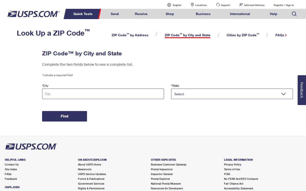
The image is a postal validation aid. It does not expose a name list, household list, or ZIP-wide owner file.
Finding Residents by Perris ZIP Code
A ZIP code search should narrow geography before it selects a record custodian. Public tools do not offer a simple ZIP-wide Perris resident export. The assessor centers on address and APN. GIS can show a ZIP layer or allow visual selection where the layer is available. VoteCal does not allow public ZIP browsing. City permits may accept an address or project number. Each path has a different record meaning.
- Validate the postal area. Check the exact address with USPS and save the ZIP result.
- Check city limits. Overlay the incorporated Perris boundary in county or city GIS.
- Capture the parcel. Use the ACR property search for APN, situs, legal description, tract, and transfer references.
- Choose the custodian. Use ACR for property and deeds, the City Clerk for city files, the court for cases, or the library for historical sources.
- Move to street scale. Once the ZIP narrows the place, use the Perris street directory by address for parcel and street work.
The phrase “residents by ZIP code” can hide several different questions. It might mean which parcels are delivered in a postal area, which voters are in an approved file, or which historical households appeared near that geography. State the source and date before comparing results.
Perris Assessor Has No ZIP Export
The Riverside ACR public assessor screen is not a ZIP code directory. Its main keys are property address and assessment number. The public result can show APN, situs, property type, legal description, value history, improvements, and transfer document references, while owner names are restricted from public web display. A ZIP may appear as part of an address, but the portal does not expose a broad owner-name search by ZIP.
Map My County can support a visual selection of parcels and may expose a ZIP layer, but layer permissions and export limits change. The research records a 2,000-feature selection limit in the service notes, which makes a block or small area more defensible than a citywide pull. Use a specific address or APN for a clean chain.
| USPS | Confirms delivery geography and postal role for a specific address. |
|---|---|
| GIS | Shows parcel, city-limit, ZIP, community, and planning layers where enabled. |
| Assessor | Turns an address into APN, situs, legal, value, and transfer facts. |
| Voter system | Self-authenticated status or qualified file, not public ZIP browsing. |
This limitation is useful. It prevents a postal boundary from becoming a guessed list assembled from unrelated public pages.
Read Perris APNs and Tracts
An APN is a parcel identifier. A tract and lot describe a subdivision pattern. A map book and page point to recorded or assessment map material. A legal description is the formal land description. These fields are better than a ZIP when the research needs to follow ownership, permits, or a historic parcel across a boundary.
Downtown Perris uses numbered streets such as 4th Street alongside lettered streets such as D Street. Newer areas use named arterials and curving tract streets. Rural valley records may use road names, rural routes, township and range, or neighboring community terms. Carry the APN and legal description through each source, then write the ZIP beside it as delivery context.
Map DTSP and PVCC Without ZIPs
The Downtown Specific Plan and Perris Valley Commerce Center are planning resources, not postal zones. The Perris zoning page directs users to search by address or `APN:` followed by nine digits and to toggle zoning layers. These plan names can explain a parcel’s land-use setting, project history, or annexation context. They cannot identify every person connected with the area.
Use the planning layer after USPS and ACR have fixed the address. A project report may carry APN tables, road names, applicants, neighboring parcels, and maps. The city’s recent GIS work added public layers and a development-project map, as described in the Perris GIS enhancements report. The City’s library reopening announcement confirms the physical access venue changed, but it does not establish a new ZIP or resident collection. Ask the City Clerk for a defined document when the report itself is not posted.
ZIP Boundaries Versus Perris City Limits
A ZIP code follows postal delivery. The incorporated Perris line follows municipal jurisdiction. An assessor parcel follows county land records. A ZCTA follows a Census statistical approximation. None should be used as a substitute for the others. An address can carry a Perris ZIP while sitting outside the city, or a city parcel can share a delivery area with a place that does not match its planning label.
- ZIP code
- A USPS delivery code that can cover more than one jurisdiction.
- ZIP+4
- An added delivery segment that narrows routing beyond the five-digit ZIP.
- PO-box ZIP
- A postal code used for boxes or a delivery role, not a residential polygon.
- Unique ZIP
- A code assigned to a single organization or special delivery point when USPS designates one.
- Carrier route
- A delivery path inside postal geography, not a public resident list.
The safe conclusion from the ZIP path is geographic: which sources and boundaries need checking. Once the address is fixed, move to APN and street records. Do not publish a ZIP-wide resident list inferred from postal geography.